
Accuracy of GEDI Lidar Ground Elevation Estimates and an Assessment of the Potential of Machine Learning to Improve Ground and Biomass Estimates
Euan Mitchell
Results RQ #1:
GEDI performs well over the two temperate forest sites, WREF and GRSM, with an approximately -1 m bias in ground elevations (Fig. 3). Steep slopes causing multi-modal ground returns are the biggest source of error at these sites. At the tropical rainforest site, LSBS, the denser canopy proves more challenging, with a 4 m bias in ground elevations, largely the result of GEDI failing to identify small amplitude ground returns beneath the thick canopy.
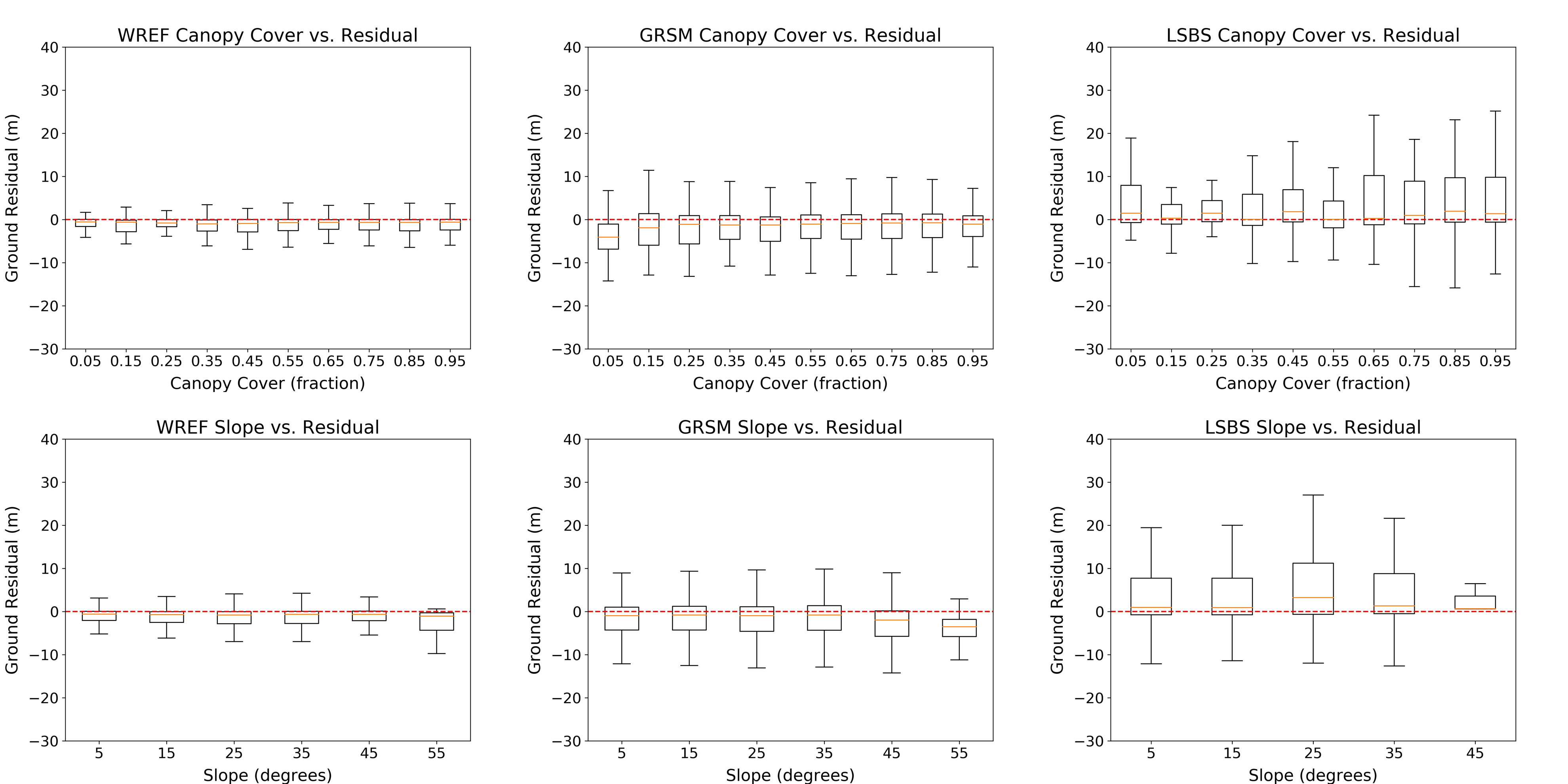
Figure 3: Ground residual (GEDI - ALS elevation) as a function of canopy cover and slope for the three study sites. Results are shown only for good quality data, as indicated by GEDI 'quality flag' values of 1.
Results RQ #2:
The Random Forest algorithm has only limited ability to predict canopy height from Sentinel-2 imagery, but can still identify outlier waveforms. Using the range of ground estimates provided in the L2A data files, the overall bias at this site can be reduced from 4 m to 1.4 m, which equates to significantly reduced error in biomass estimates, of similar magnitude to those observed in temperate forests (Fig. 4).
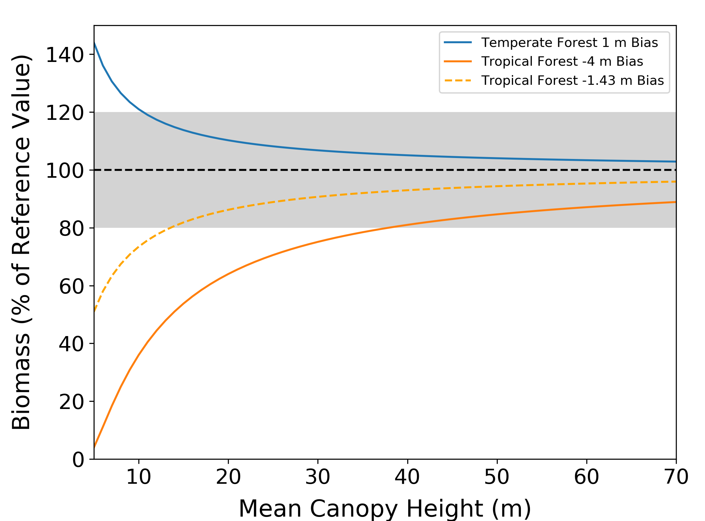
Figure 4: Error in calculated biomass as a function of mean canopy height, using the equations of Lefsky et al. (2002) for temperate forests and Asner et al. (2009) for tropical forests. Ground elevation bias is transferred to canopy height bias (e.g., a ground elevation bias of -1 m equates to a canopy height bias of +1 m) and biomass compared to the unbiased value. Blue line represents the observed bias in the temperate sites (WREF and GRSM), solid orange line represents the observed bias at the tropical site, and dashed orange line represents the tropical bias after correction using the results of the Random Forest algorithm.