
Map of Shackleton's proposed journey to the South Pole
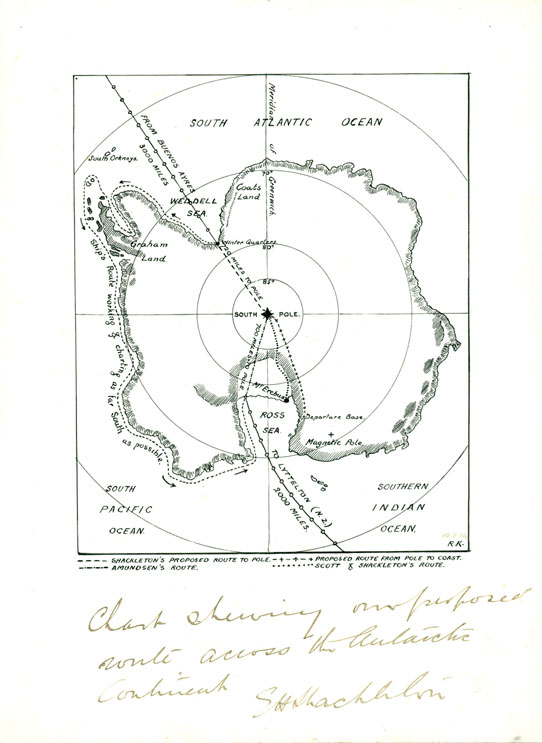
'Chart showing our proposed route across the Antarctic Continent' Shackleton
This map shows the proposed route of the Imperial Trans-Antarctic led by Sir Ernest Shackleton that attempted to make the first crossing of the Antarctic continent from the Weddell Sea to the Ross Sea. It set out in the Endurance from the East India Docks on August 1, 1914 with the goal of crossing the Antarctic from a location near Vahsel Bay on the south side of the Weddell Sea, reach the South Pole and then continue to Ross Island on the opposite side of the continent. The expedition's goal had to be abandoned when the Endurance was beset by sea ice short of its goal of Vahsel Bay. It was later crushed by the pack ice and the crew undertook an epic journey to return to South Georgia, and everyone from Endurance survived.