
The savanna woodland of Belize
Lowland savannas form the third largest ecosystem in Belize, covering an estimated 10% of the total land area. Within these savannas, Caribbean pine is the most distinctive tree species, occurring usually in patches of variable densities or scattered across semi-open to open grassland. It is the natural habitat of the endangered yellow-headed parrot, and the source of local commercial timber production. However, recent studies reveal significant decrease of the savanna woodland extent, mainly as a result of constant deforestation and anthropogenic land conversion. For the purposes mentioned, and given the high value of the Neotropical savannas in biodiversity and wild fauna habitat conservation, the regeneration of pine trees is a vital aspect of the broader sustainable management of this region.
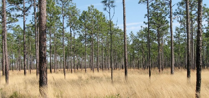 Dense pine savanna woodland
Project overview
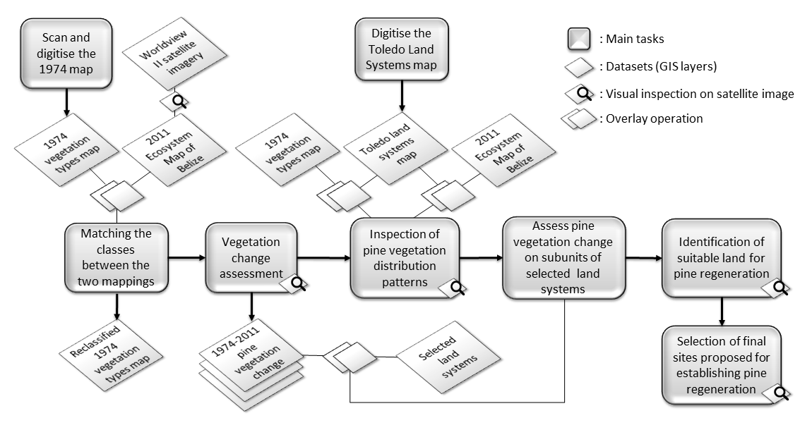
This project explores the lowland savannas of Belize’s Southern Coastal Plain with an aim to identify areas that have the environmental condition for dense savanna woodland formation. It uses land cover mappings from 1974 and 2011, and land system map that reflects the soil type and drainage, in combination with high resolution remote-sensed imagery acquired for parts of the ecosystem in 2011 to achieve the following objectives:
- 1) Estimate pine vegetation change between 1974 and 2011 and identify areas with positive and negative change;
- 2) Describe the relationships between land systems and the occurrence and distribution of different savanna ecosystem types, with an emphasis on the conditions that appear to favour pine regeneration;
- 3) Use this geographic information to assess the potential of various areas for sustaining pine woodland regeneration and propose sites that appear to be most suitable for pine seedling re-establishment based on the physical conditions and present vegetation cover.
Study area
The study area is located in the Southern Coastal Plain of the Toledo District in Belize; it covers an extensive area of the Deep River forest reserve as well as the entire Payne's Creek National Park.
Main bibliography
Cameron, I. D., Stuart, N., Goodwin, A. Z. (2011) Savanna Ecosystems Map of Belize 2011: Technical Report, Darwin Initiative Project 17022, University of Edinburgh, Edinburgh, UK. View online
Cherrington, E. A., EK, E., Cho, P., Howell, B. F., Hernandez, B. E., Anderson, E. R., Flores, A. I., Garcia, B. C., Sempris, E., Irwin, D. E. (2010) Forest Cover and Deforestation in Belize: 1980-2010, SERVIR. View online
Johnson, M. S. and Chaffey, D. R. (1974) Land Resource Study No. 15: An Inventory of the Southern Coastal Plain Pine Forests, Belize, Ministry of Overseas Development – Land Resources Division, Surrey, England. View online
King, R. B., Baillie, I. C., Bissett, P. G., Grimble, R. J., Johnson, M. S., Silva, G. L. (1984) Land Resource Survey of Toledo District, Belize, Overseas Development Administration – Land Resources Development Centre, Surrey, England.
Linares, A. V. (2009) Deep River Forest Reserve Sustainable Forest Management Plan, Thomas Gomez Sr. & Sons, Belize. View online
Meerman, J.C. and Sabido, W. (2001) Central American Ecosystems Map: 2 Volumes, Programme for Belize, Belize City. View online: Volume I Volume II