
Integrating Climate Information into the Gazetteer for Scotland
Ryland Karlovich
University of Edinburgh - School of Geosciences
University of Edinburgh - School of Geosciences
About the Project
The
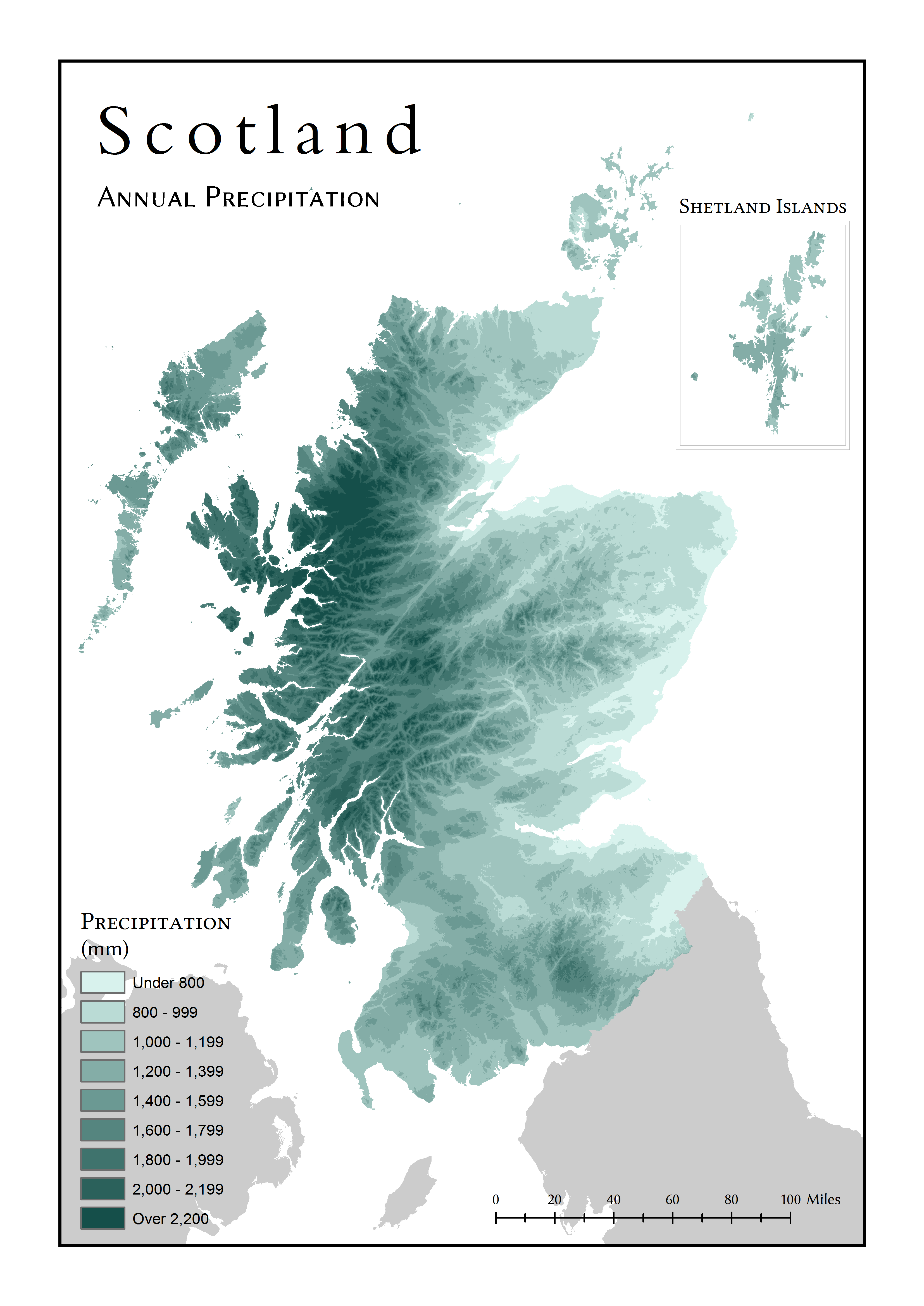
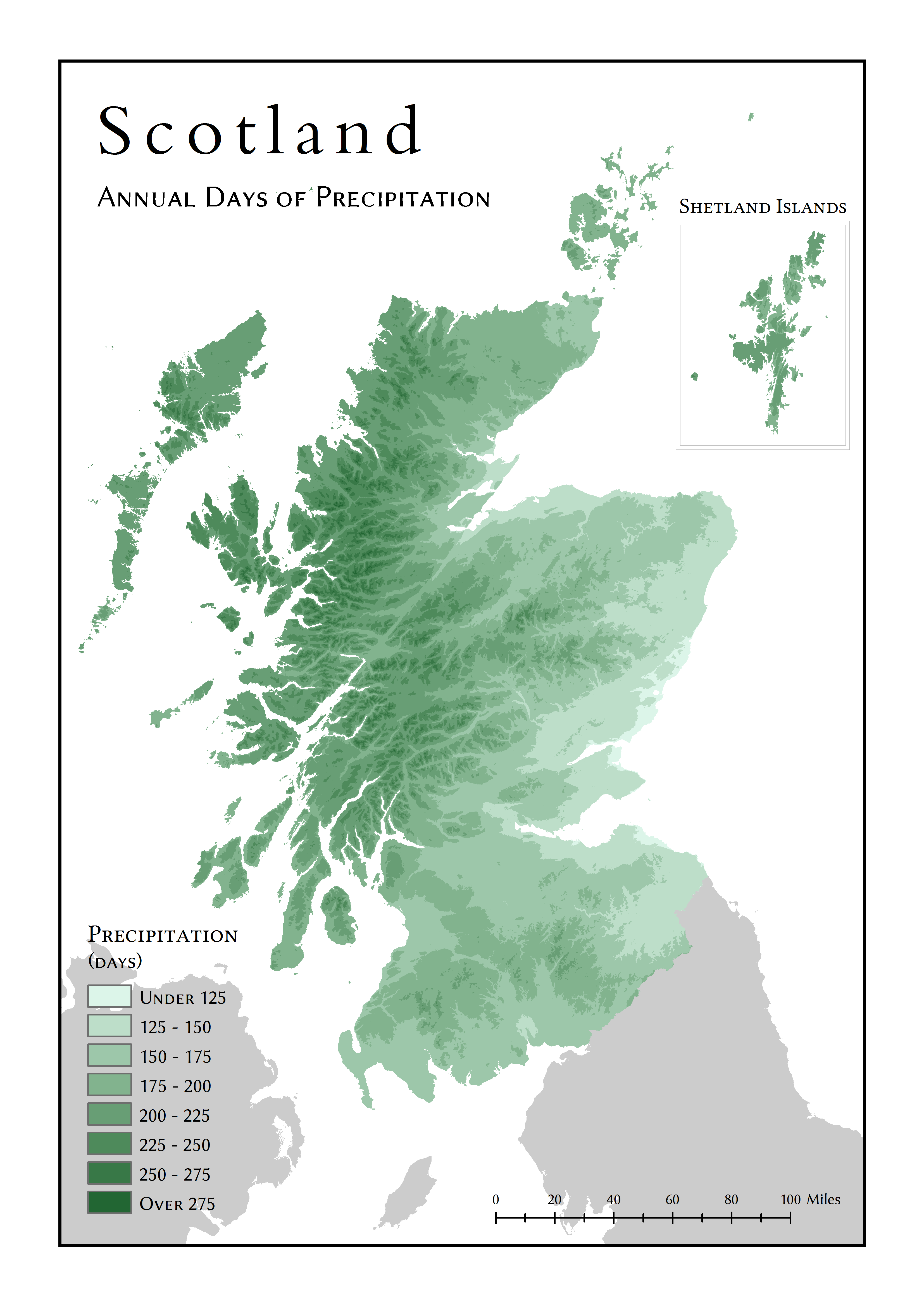
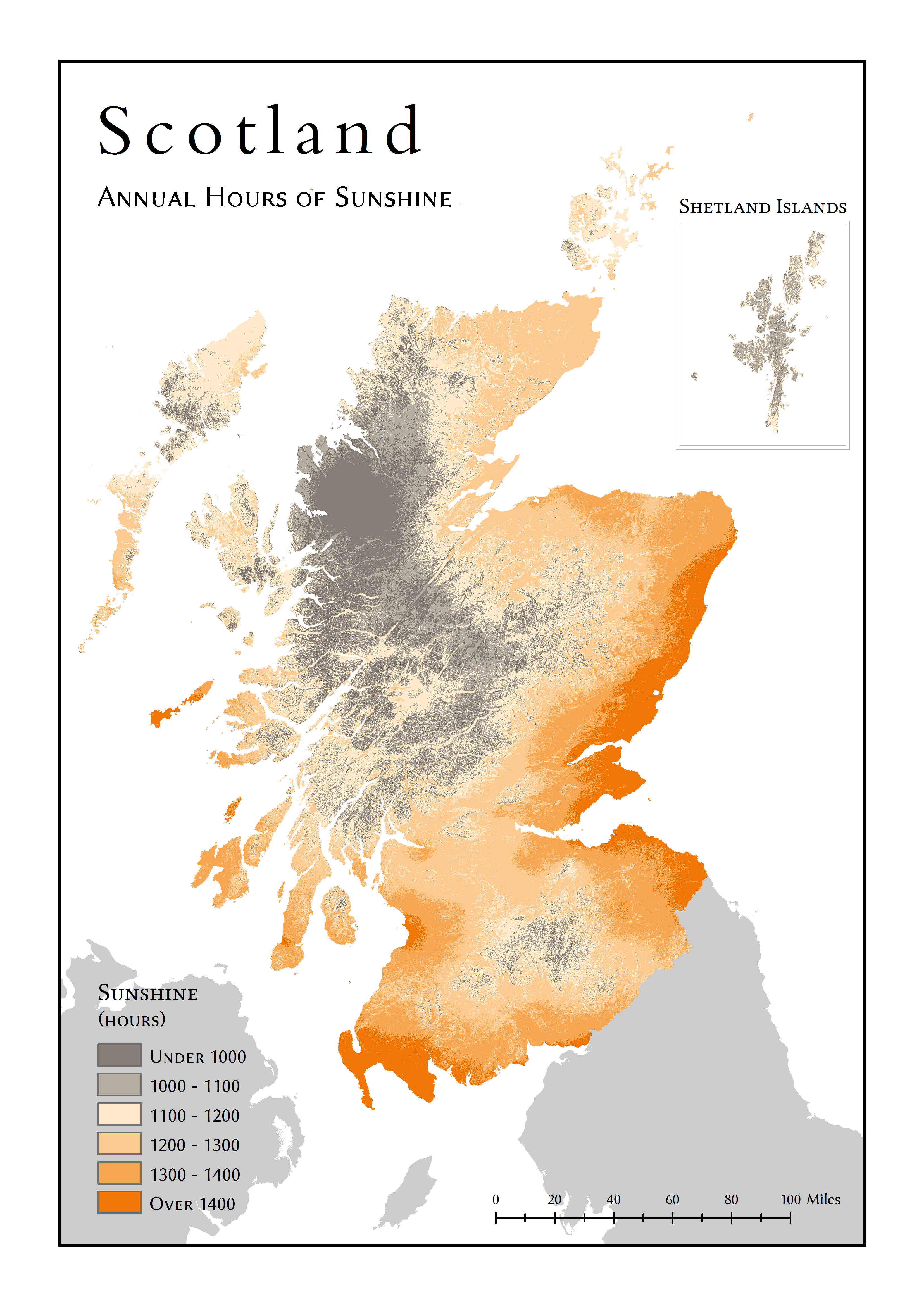
Gazetteer for Scotland indexes geographical features and provides information
about their characteristics. This project created climate estimates for all of the towns indexed
by the gazetteer and added the resulting data to the gazetteer in the form of new climate pages,
in order to improve the range of information available to users of the gazetteer. Many previous
climate analysis projects have been carried out successfully for the production of static climate
maps in the form of GIS raster surfaces, but this project goes a step further by extracting data
from the resulting raster surfaces to generate data for individual locations and present the
information in a web resource. Most of the 14,184 places analysed do not currently have any climate
information available to the public, so the production of realistic estimates for these places occurs
for the first time in this project. The project sought to:
Methodology
|
The greatest challenge in this project was to create climate estimates that were
sufficiently accurate for inclusion in a public resource, even in places with no existing climate
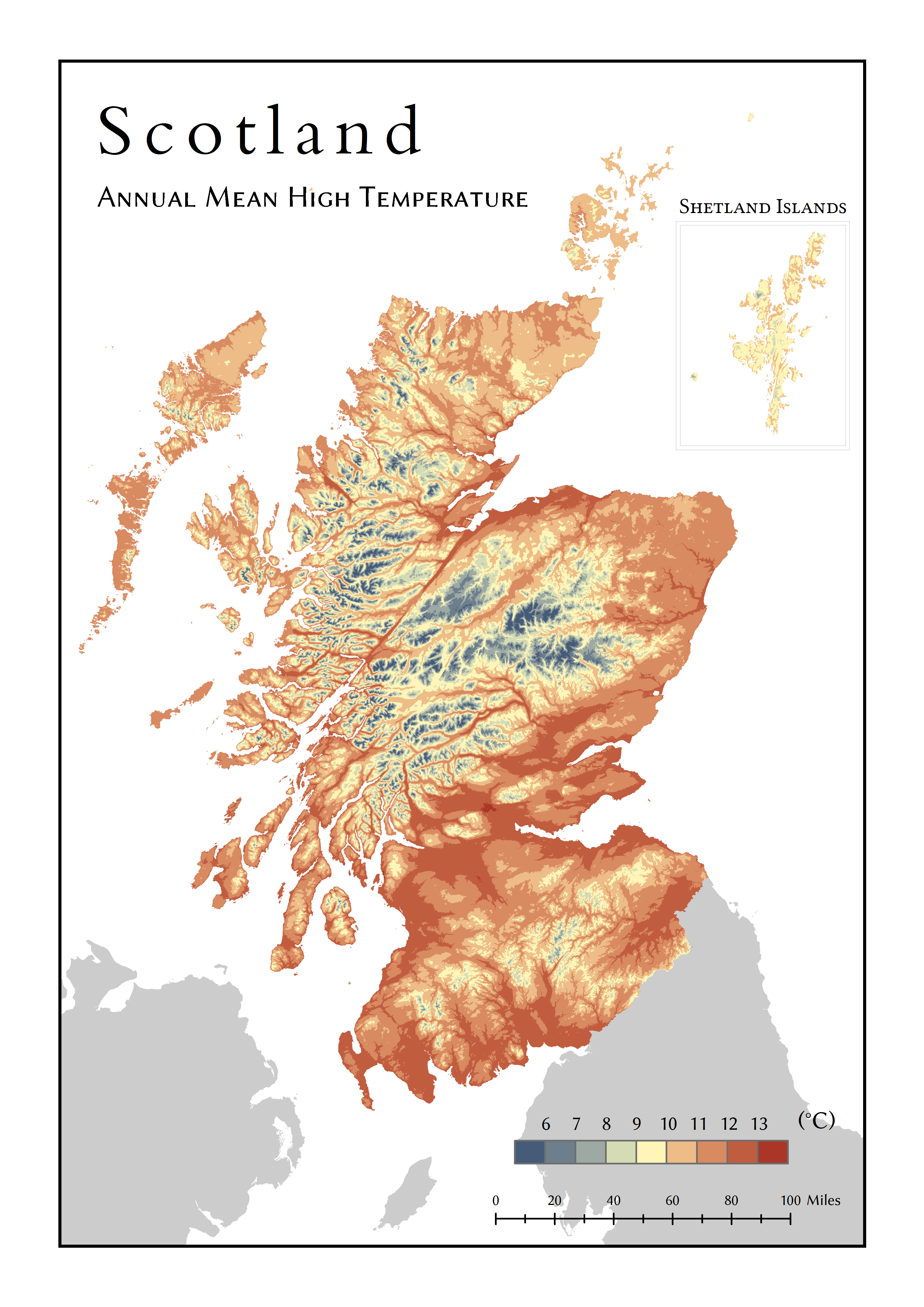
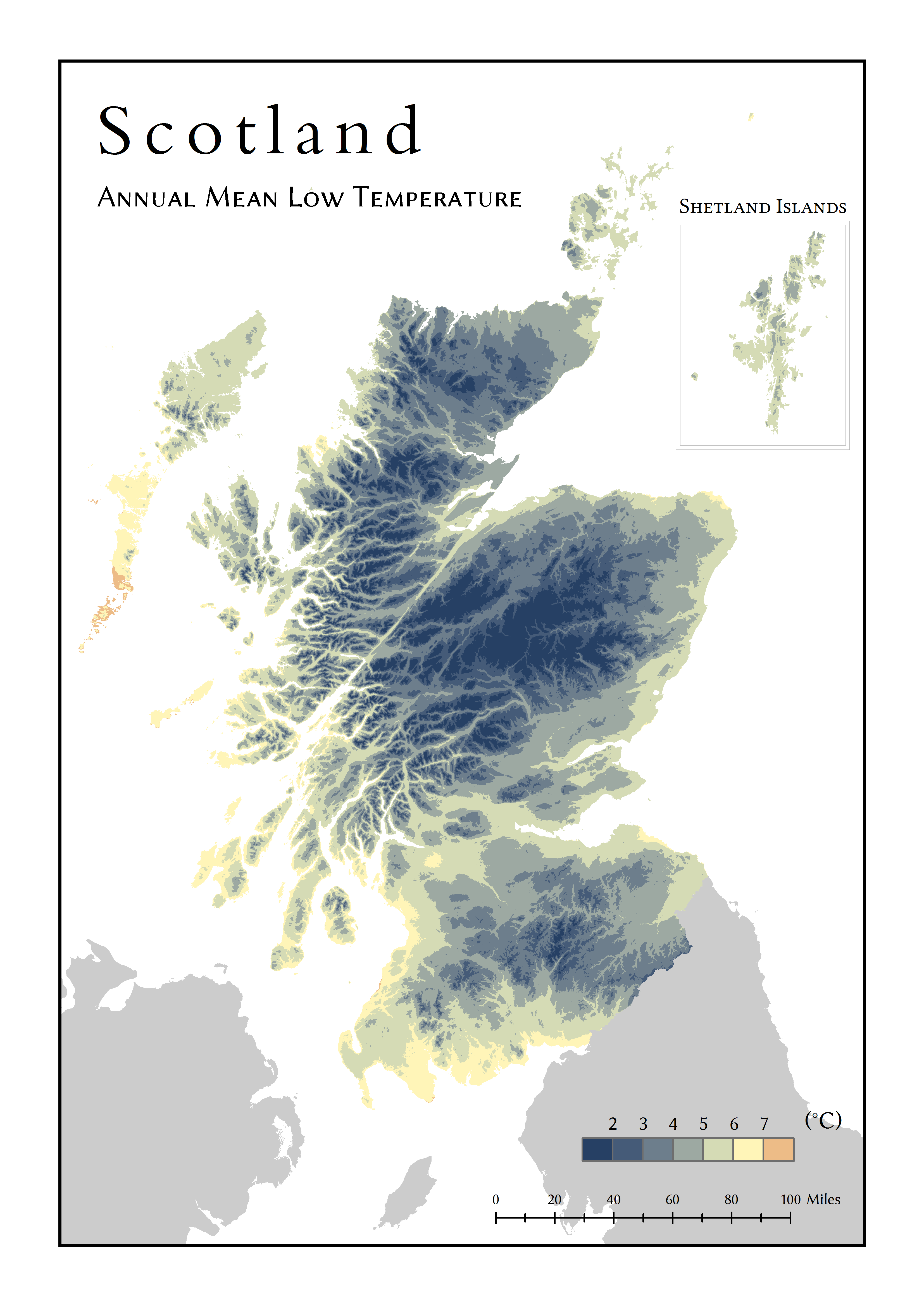
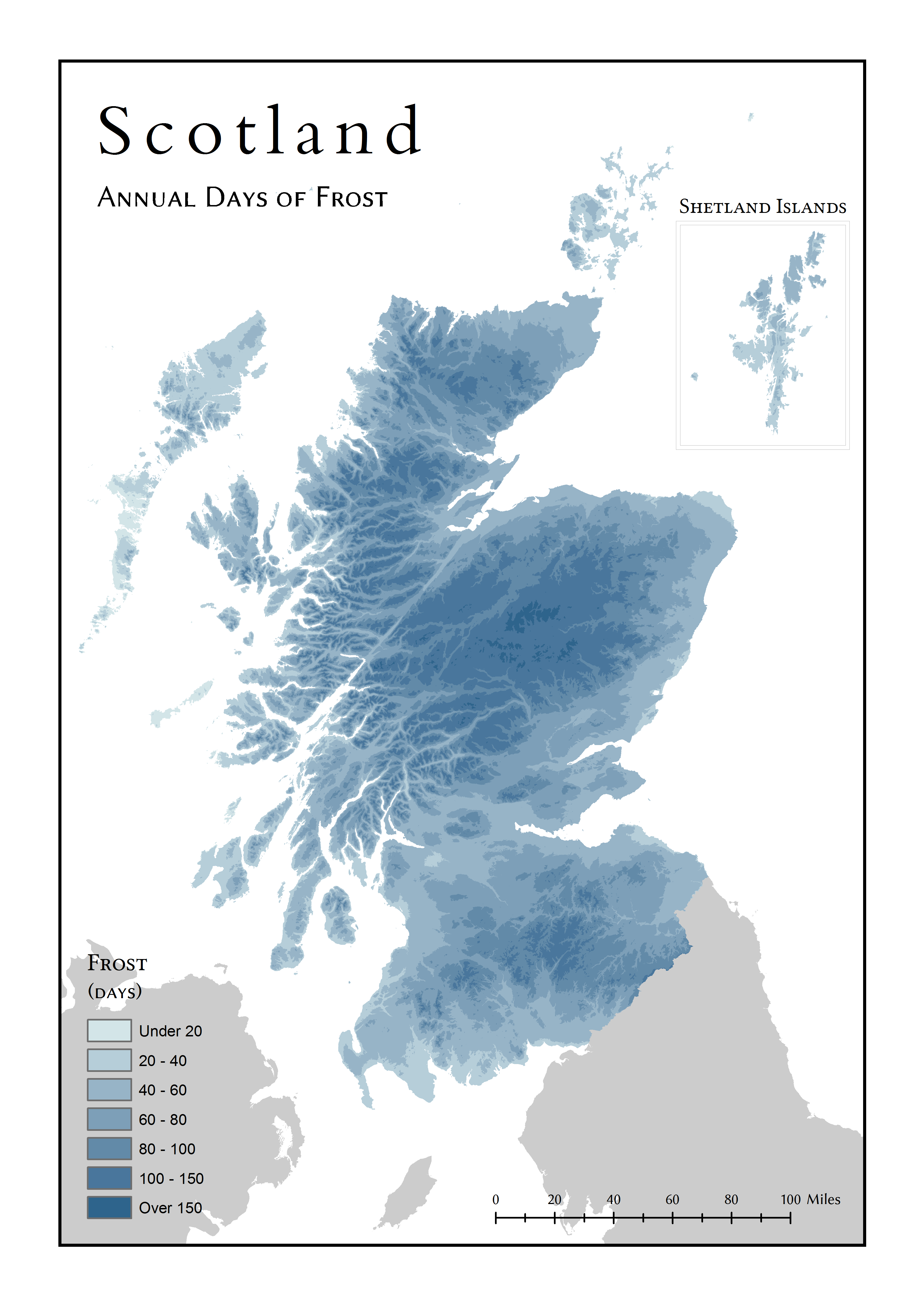
data. Long-term averages produced by the Met Office for a range of stations in the study for the
time period 1981-2010 were used as the original input data.
Estimates for all locations in Scotland were created by modelling the geographical effects (such as elevation and distance from the sea) on each climate variable through multiple linear regression in the statistical package R, then using the regression equations to subtract and effectively remove the effects for every climate station. The resulting residual values were interpolated with IDW in ArcGIS to create residual surfaces. To create realistic estimates, the previously-removed geographical effects had to be added back to the residual surfaces by re-evaluating the regression equation with rasters for each geographical variable. The values from each resulting surface were extracted to the points of every town in the Gazetteer for Scotland using ArcGIS and then stored in the gazetteer’s Oracle database. The final data is presented on the web by using Perl to retrieve the data with SQL queries and presented it in the form of HTML web pages with textual descriptions, tables, and graphs. |
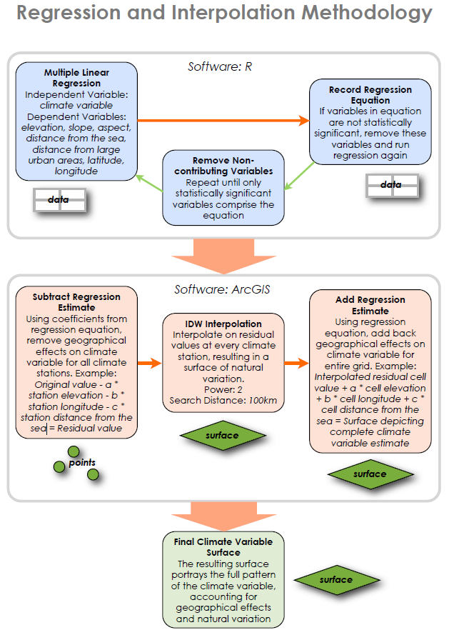 A diagram illustrating the multiple linear regression and interpolation process in the analysis (click to enlarge)
|
Results
|
By comparing the resulting climate estimates with known values in an independent dataset,
it was determined that the project achieved mean absolute errors of 0.19°C for high temperatures,
0.07°C for low temperatures, and 0.35 days per month for days of precipitation. These very low error
values compare favourably against previous projects, with the accuracy attributable to the high spatial
resolution (about 73 metres) of the analysis and the thorough range of geographical variables used in
the analysis.
A questionnaire found that gazetteer users generally approved of the inclusion of the climate information and liked the way it was presented. Based on this feedback and the low error measures, the project was successful in producing a reliable and useful resource within the Gazetteer for Scotland. It is limited by the complexity of Scotland’s climate, and it is likely that some climatological effects, such as localised frost hollows, could not be fully modelled in this analysis. There is further difficulty with presentation of climate data for locations where the climate may vary over short distances. |
Climate Pages for Selected Locations:
|
Conclusion
Despite the issues that limit the modelling of Scotland’s complex climate, the results
produced by this project have high accuracy and are the best climate estimates available for most of Scotland.
Due to the Gazetteer for Scotland’s thorough coverage, climatic variation across Scotland and even within
cities is well-represented, resulting in an extensive new resource and an improved experience for the users
of the Gazetteer for Scotland.
Key References