![[First]](s_first.gif)
|
![[Prev]](s_prev.gif)
|
![[Home]](s_home.gif)
|
![[Index]](s_index.gif)
|
![[Next]](s_next.gif)
|
![[Last]](s_last.gif)
|
|
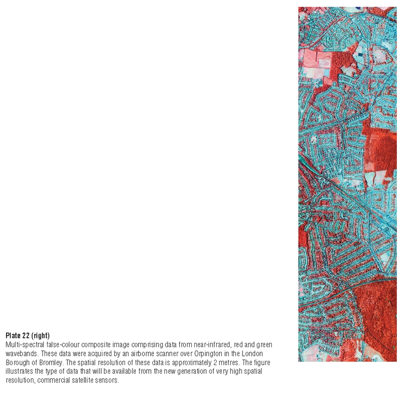
Plate 22 Multi-spectral false-colour composite image comprising data from near-infrared, red and green wavebands. These data were acquired by an airborne scanner over Orpington in the London Borough of Bromley. The spatial resolution of these data is approximately 2 metres. The figure illustrates the type of data that will be available from the new generation of very high spatial resolution, commercial satellite sensors. |
|