1. The tools you will need for these tutorials
These tutorials were developed in support of students and staff within the University of Edinburgh’s School of GeoSciences, and if you are within the school of GeoSciences, many of these open source tools are available on our computers.
However, if you are not at the University of Edinburgh, or if you are but want to use your home computer, these are the open source tools you will need to perform these analyses.
1.1. An open source GIS: QGIS
The industry standard GIS is ArcMap, and if you are at a university you might have a site license for this software. It is not so easy to get on a personal computer, however, so there are a number of open source options that can be used as an alternative.
One alternative, and the one that will be used in these tutorials, is QGIS.
If you are familiar with ArcMap, you should be able to become proficient at QGIS in a few days. In my experience, it also has the advantage of being more stable (i.e., it crashes less) than ArcMap.
One thing that is quite nice about QGIS is the number of plugins that are available.
You should download and install QGIS from their website, and click on the Plugins tab to get some plugins
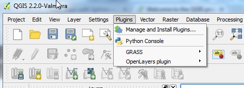
As you can see from the image, I have installed the OpenLayers plugin, which allwos you to quickly load satellite and map information from all sorts of vendors. I find it to be much better and faster than the ArcGIS version.
1.2. Open source programming: Python
Python is a popular programing language that has many, many packages for doing, well, almost anything you can think of.
Getting python all by itself and then adding things to it is not for the faint of heart, so the best way to get python on your computer is to use a prepackaged distribution.
Two popular ones are:
If you donwload and install these you should have all of the packages you need. If you want to do things piece by piece what you need in addition to python are
1.3. Open source map manipulation: GDAL
GDAL is a library for dealing with geospatial data. You will get the library with python, but most of the time you will use GDAL's utility programs.
These utility programs, particularly when run on a linux server, are so much faster than using a GIS that if you have been using a GIS to do things like clip or mosaic raster, the first time you use GDAL you will choke on your tunnocks caramel wafer and then lament all the time you’ve been wasting. Seriously. I dare you to mosaic two 100Mb rasters in ArcMap and then try the same process using gdal_merge.py (instructions for that are later in this tutorial). You will be astounded.
1.4. Open source topographic analysis: LSDTopoTools
These are a number of topographic analysis programs developed at the University of Edinburgh.
The person writing this tutorial is also the lead developer of a topographic analysis package caled LSDTopoToolbox. At this point the code is available by emailing me, but the aspiration is to have updates posted on my website.